
Overview
- Officials closed the trail between Caribou Falls State Wayside and Lake County Road 7 starting at 8 a.m. Friday as a precaution against shifting winds.
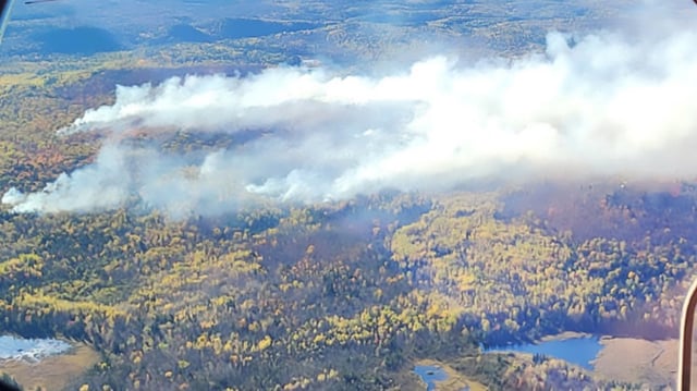
- Ground teams from the Minnesota Department of Natural Resources and the Superior National Forest are continuing suppression supported by multiple aircraft conducting water drops.
- Fire behavior is smoldering through mixed maple hardwoods and fall leaf litter, and a forecast wind shift from south to northwest could influence spread toward recreation infrastructure.
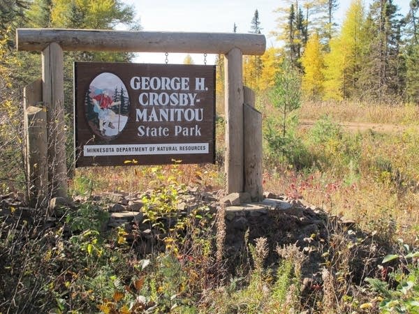
- George H. Crosby Manitou State Park remains open to visitors, and authorities warn that any drone flights would halt aerial firefighting operations.
- Improved access allowed crews to remap the blaze from an initial estimate of about 50 acres to roughly 160 acres, and the cause remains undetermined.