Overview
- Clear days and low humidity persist across the eastern U.S., with chilly nights prompting patchy frost and freeze alerts in parts of northern New England.
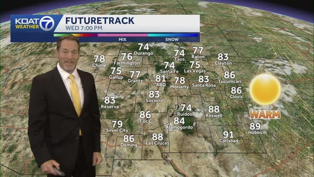
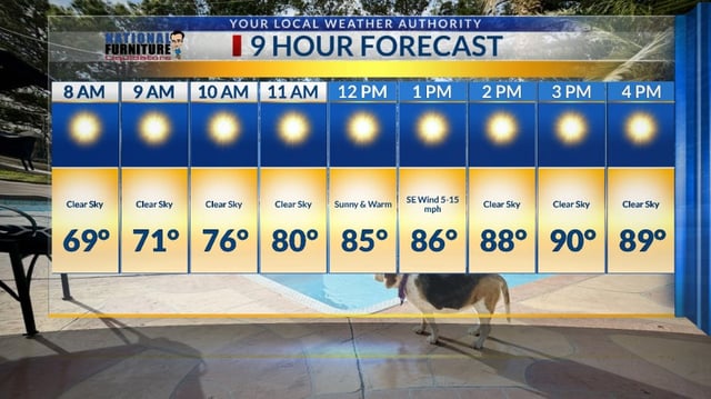
- Temperatures rebound this weekend as southerly flow returns, pushing highs into the upper 70s to low 80s and keeping conditions mostly dry into early next week.
- Forecasters flag worsening rainfall deficits and note the next meaningful opportunity for showers around Wednesday as a cold front approaches.
- Coastal forecasts call for increasing onshore winds and higher rain odds from late weekend into early next week, including small craft advisories and localized coastal flooding risks near the Gulf and Southeast.
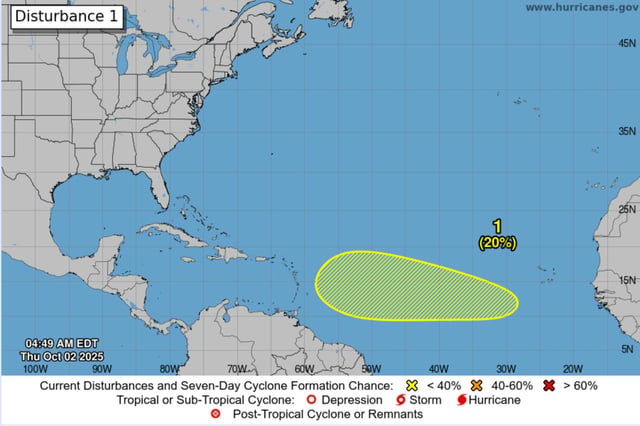
- Hurricane Imelda is moving away from Bermuda and is being monitored with no direct U.S. impacts indicated, while low-probability disturbances near the Bahamas and off Africa bear watching.