Overview
- Forecasters expect west winds to turn northeast at 10–20 mph with gusts over 30 mph as a cooler Sunday unfolds across the metro area.
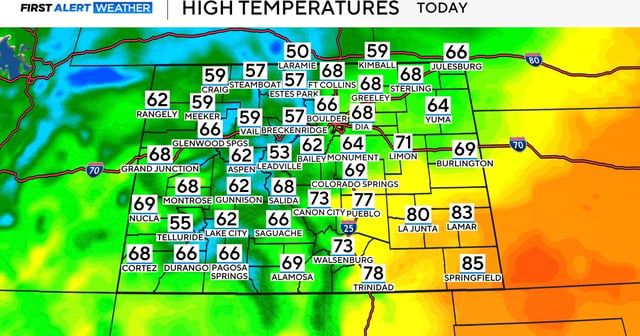
- Highs hold in the 60s for much of Colorado today, while southeast counties likely remain in the 80s.
- Showers are favored after dinnertime along the Front Range foothills and into the mountains, with snow possible on the highest peaks.
- Rain in Denver and high-country snow should taper a little after midnight, with lows in the upper 30s to low 40s and lingering northeast gusts.
- Monday trends cooler with highs in the upper 50s to low 60s and late-day rain chances, then drier weather returns Tuesday before 70s build from Wednesday into mid-October, running roughly 10 degrees above normal.