Overview
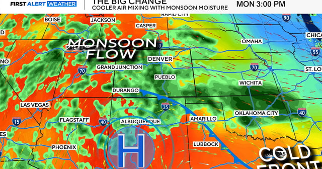
- The National Weather Service forecasts scattered thunderstorms statewide Monday that intensify as they move east, with Denver’s highest likelihood of heavy rain around late afternoon to early evening.
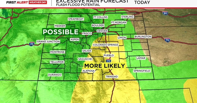
- A flood watch runs from noon into the evening for parts of Fremont, Teller, El Paso, Pueblo and Las Animas counties, including the Rampart Range and Pikes Peak area.
- Southeastern Colorado faces the highest severe risk, with hail up to 2 inches in diameter and wind gusts up to 70 mph possible under stronger storms.
- Forecasters warn of localized flash flooding, especially on burn scars and in low-lying corridors, and urge people to seek sturdy shelter and drivers to avoid flooded roads.
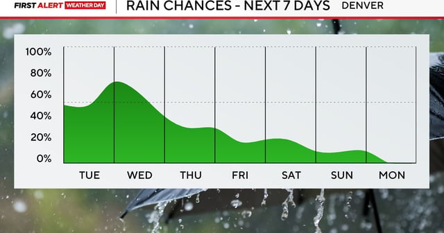
- Cooler highs in the 60s and 70s accompany several more days of storm chances across the state, with additional rounds of heavy rain possible into midweek.