
Overview
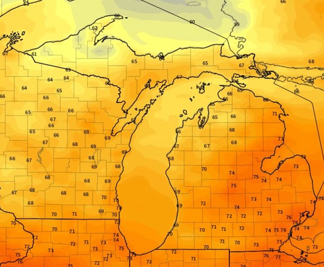
- Dry, comfortable weather holds through Thursday and Friday with sunshine, low humidity and highs around the mid‑70s to near 80 degrees.
- Showers and a chance of non‑severe thunderstorms arrive Saturday, starting in northwest Lower Michigan in the morning and reaching Ann Arbor and Detroit late afternoon, with a few hours of rain at most spots.
- NOAA guidance indicates modest weekend rainfall, heaviest in the Upper Peninsula at about 0.5–1.0 inch, 0.25–0.5 inch in Northern Lower, and 0.10–0.25 inch across Southern Lower.
- Cooler post‑frontal air will favor spotty lake‑effect showers Sunday in northwest snow‑belt areas and the Thumb, with limited precipitation farther south.
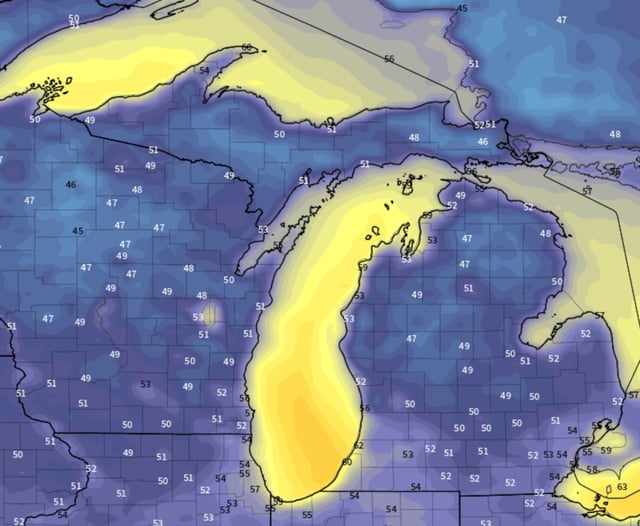
- Highs fall into the upper 60s to low 70s early next week with some inland morning lows dipping into the upper 40s to low 50s, and the Labor Day outlook trends cooler than typical but remains uncertain.