


Overview
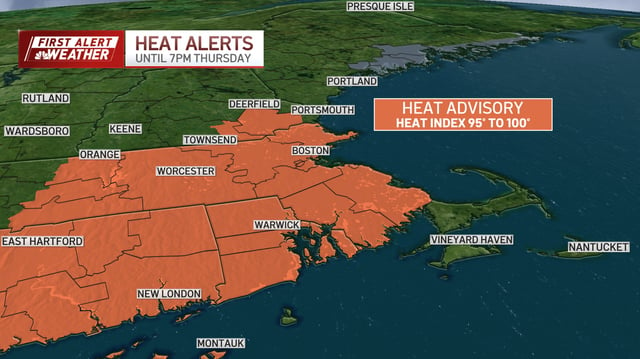
- The National Weather Service has issued a Heat Advisory through 7 p.m. Thursday for Boston and parts of New England, with heat index readings reaching around 100°F.
- A cold front arriving Thursday afternoon is expected to trigger scattered showers and isolated thunderstorms across the region.
- Heavy downpours linked to the front may cause localized flash flooding in western and northern New England.
- Behind the front, humidity will plummet Friday, with dew points falling into the 50s and highs in the 70s and low 80s.
- A second frontal system on Sunday will bring renewed chances of rain and thunderstorms, with daytime highs in the upper 70s.