Overview
- Scattered showers and thunderstorms develop along the I-25 corridor and eastern plains Monday afternoon and evening, with most storms staying below severe limits.
- North winds shift in behind the front with gusts near 30 mph, dropping temperatures quickly from earlier warmth.
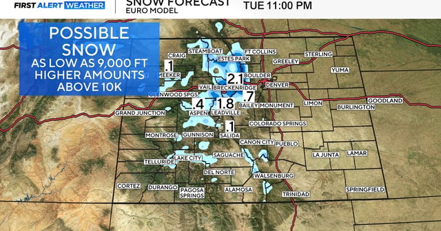
- Snow levels lower to around 9,000 feet, possibly near 8,500 feet by early Tuesday, with accumulations on higher northern Front Range peaks.
- Slick travel is possible late Monday night into Tuesday morning on mountain passes such as Berthoud Pass and areas near Trail Ridge Road.
- Tuesday features widespread showers and the week's coolest highs in the 50s to low 60s for Denver, with a First Alert Weather Day in effect and patchy frost possible in mountain valleys by Wednesday.