

Overview
- National Weather Service guidance highlights today as the peak for rain as the front crosses, with the Storm Prediction Center posting a marginal risk for damaging wind gusts and a brief tornado.
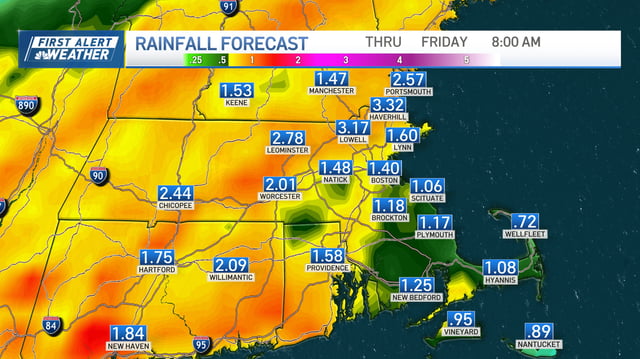
- Meteorologists target the afternoon into the evening for the strongest cells, with most areas seeing 0.25"–1" of rain but narrow bands producing 1.5"–3" and localized flash flooding.
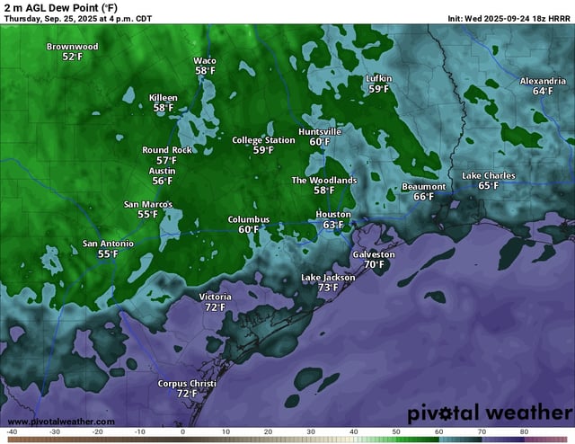
- Showers and embedded thunderstorms are affecting commutes from New England to the Mid-Atlantic and along parts of the Gulf Coast, with ponding on roads and reduced visibility in heavier downpours.
- Conditions turn drier and less humid behind the front on Friday, setting up a more comfortable weekend, though a few lingering or returning showers are possible in some locales.
- Forecasters are also tracking Tropical Storm Humberto in the Atlantic and a disturbance near Hispaniola and the Bahamas with medium-to-high development odds that could influence coastal weather next week.