Overview
- Morning downpours tapered by midday with most areas logging 0.5–1.0 inch of rain and isolated higher totals that briefly slowed commutes.
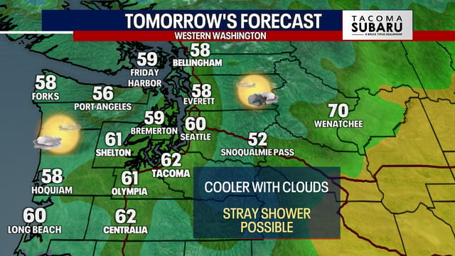
- Dry northwest winds are ushering in cooler, less humid air with highs in the 50s to low 60s and overnight lows dropping into the 30s and 40s.
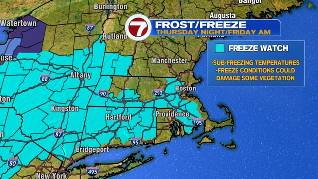
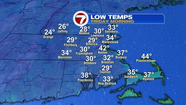
- Frost and freeze alerts are posted for late Thursday night into Friday morning in inland and suburban zones, with a risk to sensitive vegetation.
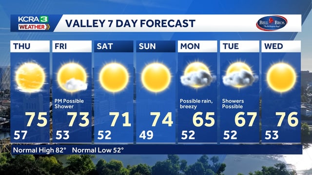
- High pressure brings clearing and a seasonably cool, mainly dry stretch through Saturday after the front.
- Forecasters are tracking a potential coastal low that could brush parts of the Northeast late Sunday into Monday, and Tropical Storm Jerry remains offshore with no U.S. threat.