


Overview
- Showers and embedded downpours arrive late tonight into Wednesday morning across much of the Northeast and Mid-Atlantic, with rain tapering by midday and clearing in the afternoon.
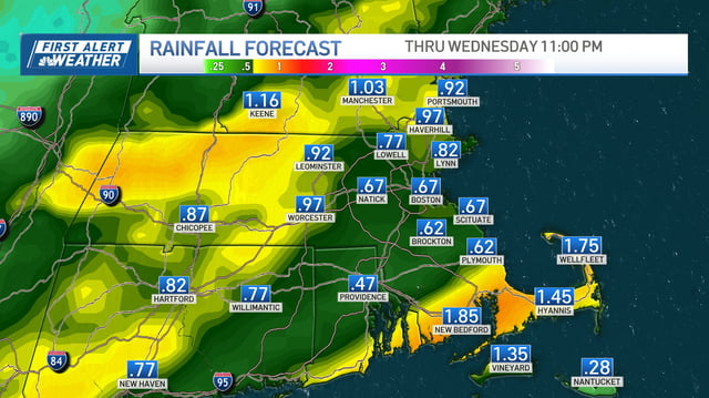
- Most locations are forecast to pick up around 0.5–1.0 inch of rain, though localized bands could deliver 1–3 inches or more in spots.
- After a dry stretch, initial rainfall may create slick roads and brief ponding during the overnight and morning commute, with the severe storm threat generally low.
- Cool, dry high pressure builds in behind the front, knocking highs into the 50s and 60s and bringing a late‑week frost risk for inland and other cold‑prone areas.
- Meteorologists are tracking a tropical or coastal low with a high chance of development later this week, but potential weekend effects along the East Coast remain uncertain.