


Overview
- Overnight into Wednesday morning, periods of rain and scattered downpours are producing wet commutes before tapering by afternoon as skies slowly clear.
- Most locations are expected to receive a few tenths to roughly 0.5–1.5 inches of rainfall, with gusty winds shifting northwest as the front passes.
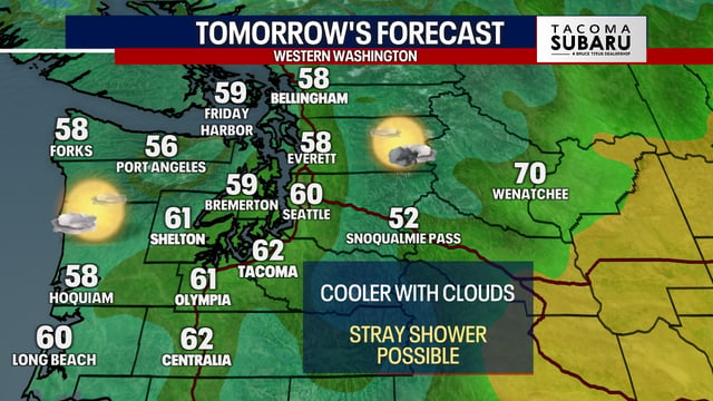
- Daytime highs fall into the 50s and 60s through late week, and forecasters highlight a frost risk Thursday night into Friday in the coldest inland areas.
- Forecast models point to a possible coastal low near the Southeast this weekend, but track and intensity remain uncertain, leaving potential East Coast impacts unclear.
- Out West, a slow-moving low is likely to deliver mountain snow this weekend into early next week, and the NHC continues to track Tropical Storm Jerry with watches posted for parts of the Leeward Islands.