
Overview
- Official alerts are in place across multiple regions, including Warnstufe 2 for parts of South and Central Hesse where strong thunderstorms may cause flooded streets and basements.
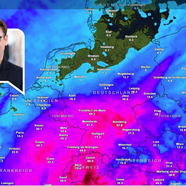
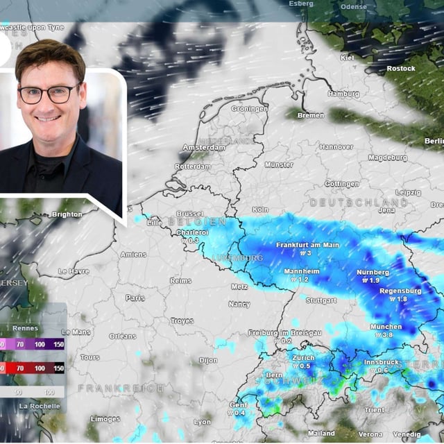
- Forecasts point to the heaviest rain from the center into the south, with the DWD warning of 25 to 60 l/m² in parts of Baden‑Württemberg by Monday and some model guidance indicating 60 to 100 l/m² locally through midweek.
- Coastal and exposed areas face strong to storm‑force gusts, with 65 to 85 km/h likely and peak values near 90 km/h on higher terrain.
- Daytime highs fall to roughly 10 to 18°C early this week with much cooler nights and isolated ground frost risk in favored inland spots.
- Thunderstorms and downpours may disrupt major events, with showers and storms possible for the Berlin Marathon on Sunday and rain and gusts forecast for Oktoberfest, as authorities urge close attention to DWD updates.