
Overview
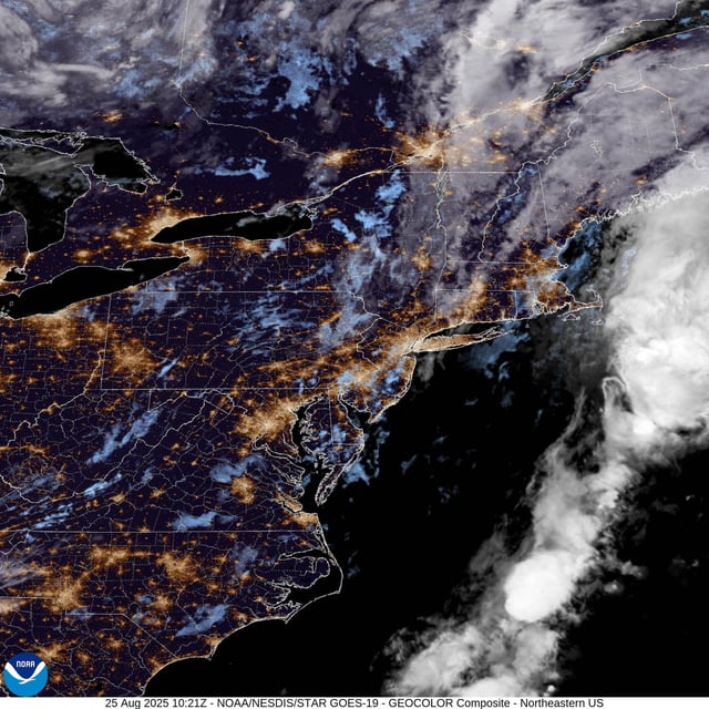
- Scattered, mostly light showers and a few non-severe storms ended Monday across New England and Maine, offering little relief for ongoing drought that has Portland and Burlington on track for record-dry Augusts.
- Drier air settles in through midweek with sun, cooler nights and low dew points, though a weak late‑week disturbance could spark a few showers Thursday into Friday.
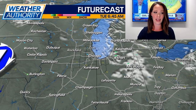
- A broad cool spell across the Midwest and Great Lakes is delivering 30s–50s in the mornings and highs stuck in the 60s to low 70s, 8–15 degrees below late‑August norms.
- Forecasters report lake-effect clouds and spotty showers downwind of the lakes, with NWS advisories highlighting 3–5 ft waves on Lake Erie and 3–6 ft on northwest Indiana beaches, plus rip-current and waterspout risks.
- In Michigan, a Thursday cold front is expected to bring a several-hour period of rain before a largely dry Labor Day weekend with a gradual warm-up into the mid‑to‑upper 70s and near 80 by Monday.