


Overview
- Showers and embedded downpours are moving through overnight into Wednesday morning, with many areas picking up 0.5–1.0 inches of rain and isolated spots near 1.5 inches as gusts reach 20–30 mph.
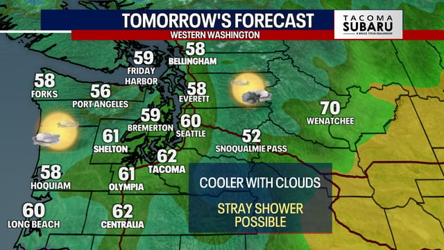
- Rain tapers west to east by midday with clearing by late day, and temperatures fall into the 50s and 60s by afternoon before plunging into the 30s and 40s at night.
- Frost is possible in colder inland and valley locations Thursday night into Friday morning as the first notably chilly air mass of the season settles in.
- Rainfall will be uneven with some locales seeing only spotty showers or a brief rumble of thunder, while no widespread severe weather is expected.
- Forecasters are watching a potential weekend coastal low with track and intensity still uncertain, as tropical moisture from Priscilla boosts showers in the Southwest and the NHC tracks Tropical Storm Jerry, while wildfire smoke drives an air-quality alert near Wenatchee in central Washington.