

Overview
- The DWD has active regional alerts for thunderstorms, persistent rain and gusty winds, including a level‑2 thunderstorm warning issued Sunday for South and Central Hesse.
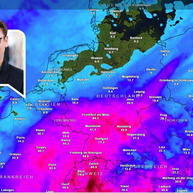
- In Baden‑Württemberg, the DWD expects widespread 30 to 50 l/m² by Monday afternoon with local peaks up to 60 l/m² near the Hochrhein, Schwarzwald and western Bodensee, and it flags small‑stream flood potential.
- Along the North Sea and exposed northern areas, forecasters warn of stürmische Böen, commonly around 65 to 85 km/h with isolated coastal gusts near 80 to 100 km/h.
- Temperatures tumble as the front sweeps east, with highs of roughly 9 to 13°C in parts of the southwest on Monday and about 12 to 18°C elsewhere.
- Central and southern regions face a multi‑day rainfall episode that could affect events and overwhelm drainage, so authorities urge the public to follow DWD updates.