

Overview
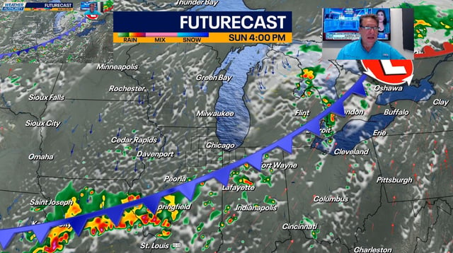
- Late Sunday, a cold front triggered scattered showers and thunderstorms across Chicago and Northeast Ohio and eased daytime heat indices from around 100°F to the low 90s.
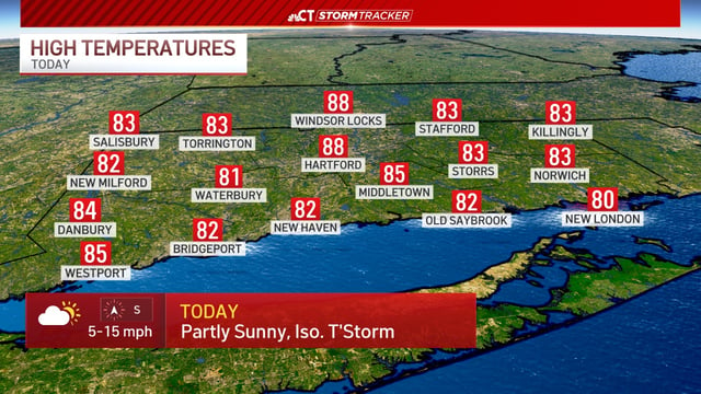
- Monday’s highs in both regions have dropped to the mid-80s, aligning closer to seasonal averages after days of highs near 95°F and oppressive humidity.
- The National Weather Service predicts a 50% chance of rain and storms on Monday in the Chicago and Cleveland areas, with additional thunderstorm risk continuing into midweek.
- In New England, a heat advisory remains in effect through Monday night as temperatures hover in the low 90s with heat indices near 100°F until another frontal system arrives later this week.
- Lake Erie water temperatures climbing into the 60s and 70s are providing a natural cooling option for swimmers and boaters seeking relief from lingering humidity.