
Overview
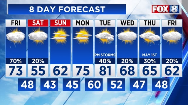
- After a warm and sunny Thursday with highs in the upper 70s, Northeast Ohio faces a significant weather shift starting Friday.
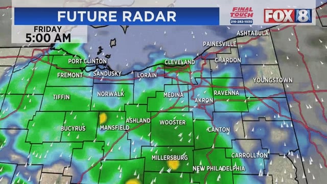
- A cold front moving through the region on Friday will trigger scattered showers and isolated thunderstorms, intensifying into the evening and overnight hours.
- Humidity and dew points near 60°F, combined with daytime highs in the 70s, are fostering atmospheric instability, though severe storms are not widely expected.
- Saturday will bring a noticeable cooldown, with morning lows in the mid-40s and daytime highs only reaching the mid-50s under clearer skies.
- Frost is possible in higher terrain areas, such as the Central Highlands, as temperatures dip into the mid-30s overnight into Sunday.