Overview
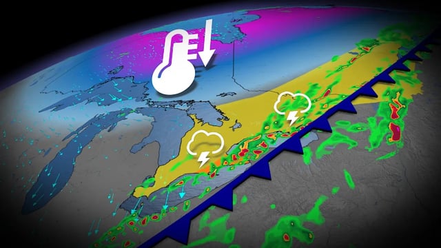
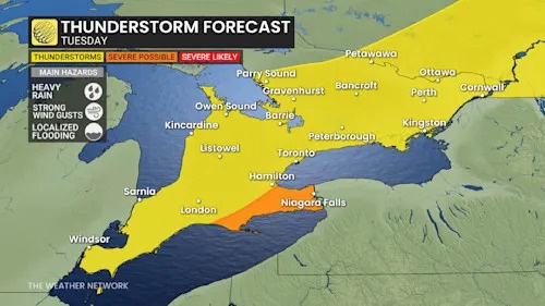
- Showers and isolated thunderstorms moved in Tuesday, delivering Toronto’s first significant rainfall in weeks with 10–20 mm forecast by Environment Canada.
- The Niagara Peninsula faces the greatest risk for heavier downpours at 20–30+ mm and localized flooding, with slower commutes expected during the rain.
- Temperatures tumble into the low to mid teens Wednesday and Thursday, with widespread frost likely Thursday morning outside urban cores.
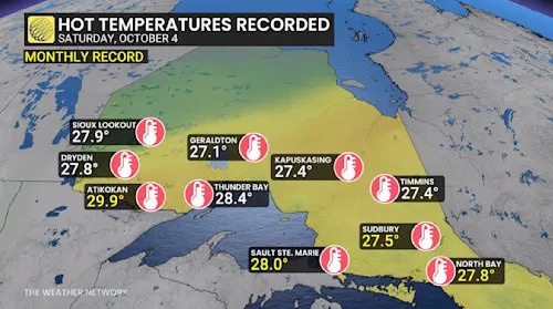
- The cooldown ends a late-season warm spell fueled by a strong ridge, which produced multiple near- or above-30°C readings including 30.8°C in Sarnia and 30.4°C in Windsor.
- A modest rebound is expected by Friday and through the Thanksgiving weekend, with near- to slightly above-seasonal readings and October trending somewhat warmer than normal overall.