Overview
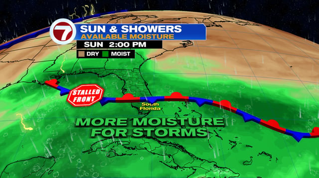
- Bands of showers and thunderstorms continue today into early week from South and Central Florida to the Lowcountry and parts of the northern Gulf Coast, with localized 1–3 inch downpours and brief urban flooding.
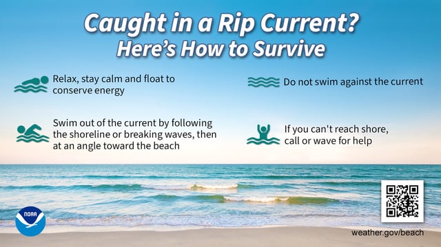
- High surf, life‑threatening rip currents and pockets of coastal flooding are in effect along Atlantic beaches, with king tides peaking near 9.5–9.9 feet early this week and small craft advisories where seas reach 7–12 feet offshore.
- Flood Watch is posted for Volusia and Brevard counties in Central Florida, and coastal flood advisories are noted in parts of southeast Louisiana as onshore winds keep tides and water levels elevated.
- The National Hurricane Center now tags Invest 95L south of the Cabo Verde Islands with a high seven‑day formation chance around 70%, with a tropical depression likely by mid to late week as it moves toward the central Atlantic and nears the Leeward Islands.
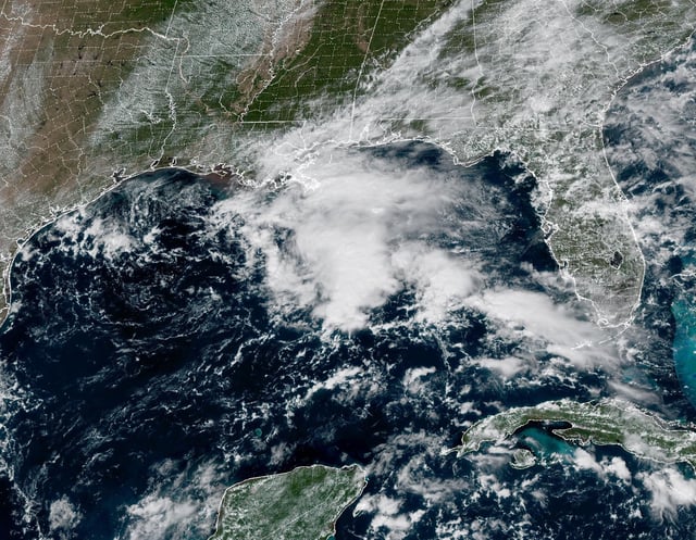
- A weak low in the northern Gulf carries a 0% development chance while drifting toward the Texas coast by Monday, yet it will still deliver periods of rain and enhance rip currents and surf along nearby shorelines.