Overview
- Tuesday features sunshine and highs near 80°F, likely the warmest day of at least the first half of September and the first 80-degree reading in 10 days.
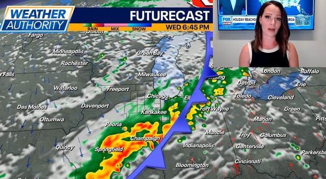
- Forecasters expect increasing clouds Wednesday with highs in the mid- to upper-70s as a cold front approaches.
- Showers and thunderstorms are possible later Wednesday as the front moves across Chicagoland.
- Significantly cooler air follows late in the week, with highs falling to the mid-60s by the end of the workweek.
- The 6–10 day outlook for Sept. 4–8 points to much-below-normal temperatures across the Midwest and Great Lakes, resembling mid-October conditions.