
Overview
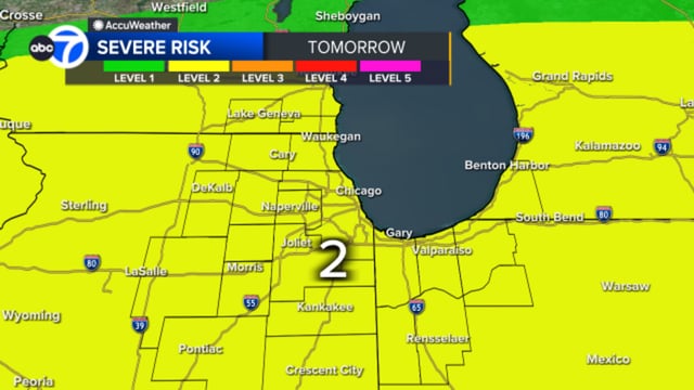
- The metro area is under a Level 2 of 5 slight risk for strong to severe thunderstorms Saturday, with the main threat between 9 a.m. and 3 p.m.
- Model consensus indicates storm complexes arriving from the northern plains could bring heavy rain, damaging winds and hail through early afternoon.
- Pre-dawn showers may give way to more organized storms, with their intensity dependent on overnight evolution over Iowa and Minnesota.
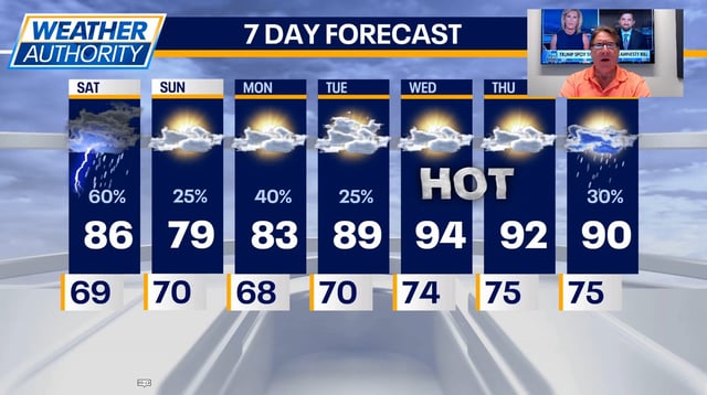
- Periods of rain and thunderstorms are expected to continue into early next week ahead of building high pressure.
- A dome of high pressure will then push heat and humidity into the upper 80s and low 90s next week, and rounds of strong to severe storms could return Tuesday through Friday.