Overview
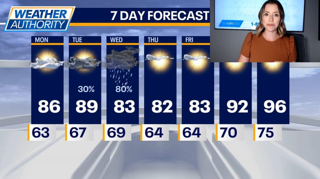
- Tuesday will see highs near 90 degrees ahead of late-day showers with the Storm Prediction Center placing northeast Illinois in a Marginal Risk for severe weather.
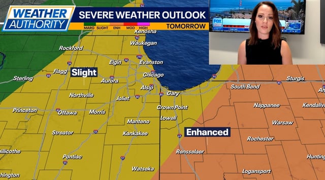
- Wednesday carries a Slight Risk for severe storms, where gusty winds and hail may accompany intermittent storms with highs in the upper 70s to near 80 degrees.
- Thursday’s storm exit will usher in milder conditions with daytime highs returning to the low to mid-80s under mostly sunny skies.
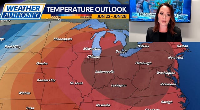
- The region’s first true heat wave of the year is forecast to begin Friday, bringing consecutive days of 90-plus temperatures.
- Weekend heat is expected to peak in the mid-90s with heat index values exceeding 100 degrees into early next week, prompting National Weather Service alerts on hydration and limiting outdoor exertion.