Overview
- A flash flood warning issued Saturday evening by the National Weather Service stays in effect through Saturday night for Cherokee County as storms continue to produce heavy rainfall.
- Radar data show 1 to 2.5 inches of rain have already fallen in the warned area, and forecasters predict up to two more inches, heightening the chance of streams and underpasses overflowing.
- Residents are urged to avoid driving through flooded roads, heed the NWS mantra “turn around, don’t drown,” and move to higher ground if flash flooding begins.
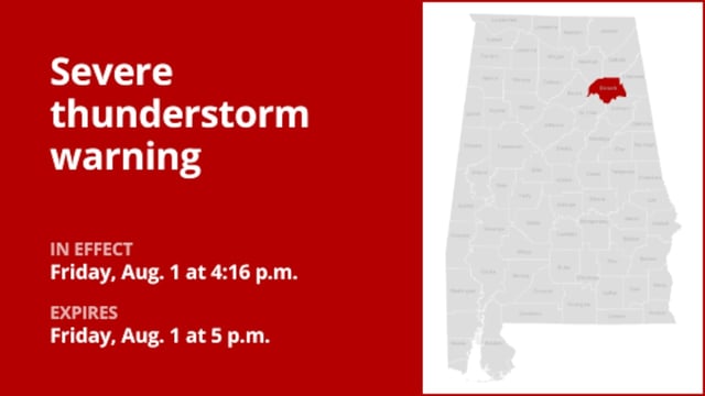
- Earlier severe thunderstorm warnings for quarter- and marble-sized hail and wind gusts up to 60 mph in Oregon and multiple Alabama counties have now expired as the system weakens.
- The NWS also warns that cloud-to-ground lightning can strike up to 10 miles from the storm and reminds drivers to maintain safe distances and reduce speed on wet roads.