

Overview
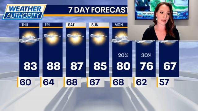
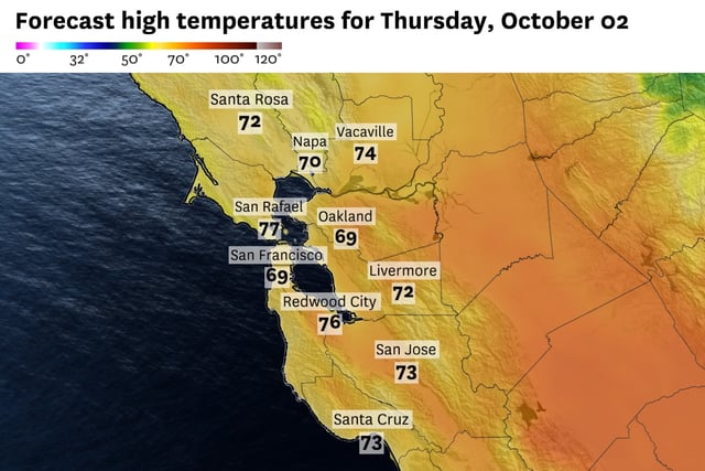
- Cool, dry mornings today give way to a rapid warmup, with widespread 80s and isolated near-90°F readings expected this weekend and some inland spots eyeing daily records.
- New England starts chilly with pockets of frost and freeze alerts, but temperatures rebound into the 70s to near 80 by Friday and approach 80 again Sunday.
- Rain chances stay low through the weekend for many areas, then increase Monday to Wednesday as a cold or stalled front brings scattered, uneven showers and a few thunderstorms.
- Dry soils and rainfall deficits persist, and the early-week precipitation signals limited relief rather than a broad dent in ongoing drought.
- Coastal impacts continue to be monitored, with small craft advisories and localized coastal flood risk in some eastern-facing shores, as Hurricane Imelda moves away from Bermuda and a Bahamas disturbance holds low development odds.