Overview
- The National Weather Service has placed the Brazos Valley north of Houston under a flood watch through Thursday evening as multiple storm clusters move through the region.
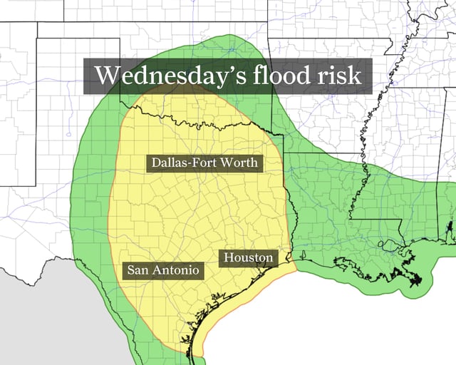
- The Weather Prediction Center has flagged the Houston metro at a level 2 out of 4 flash flood risk with downpours of several inches possible in short periods.
- The Storm Prediction Center has issued a slight risk for severe thunderstorms in Southeast Texas, warning of 60-mph gusts, hail up to 1 inch and isolated tornadoes.
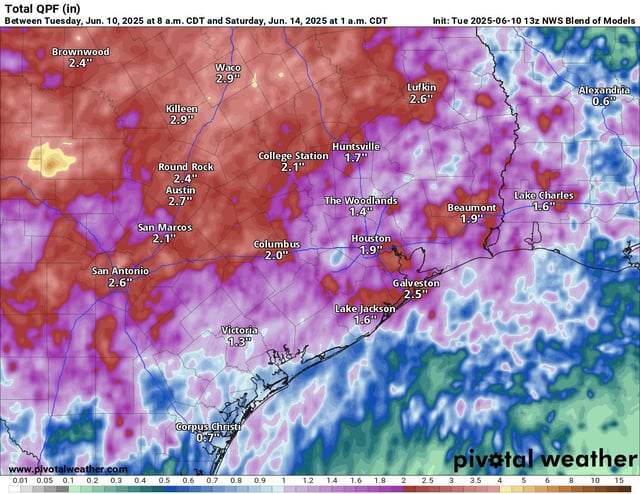
- Meteorologists say a moist low-level jet interacting with outflow boundaries will drive persistent heavy showers and thunderstorms, with some areas in northeastern Texas poised to receive a month’s worth of rain in two to three days.
- Forecasts call for additional heavy rain through Friday, but models show flood threats should subside by weekend as storm strength gradually wanes.