


Overview
- Inmet maintains widespread warnings through this morning for heavy rain, thunderstorms and strong gusts across the North, Center-West and parts of the Southeast, with a higher “Perigo” level in west Acre and southwest Amazonas.
- Most of Tocantins is under a storm and possible hail alert until 10 a.m. today, with forecast rain up to 50 mm and winds of 40–60 km/h and guidance to avoid sheltering under trees and to keep emergency contacts at hand.
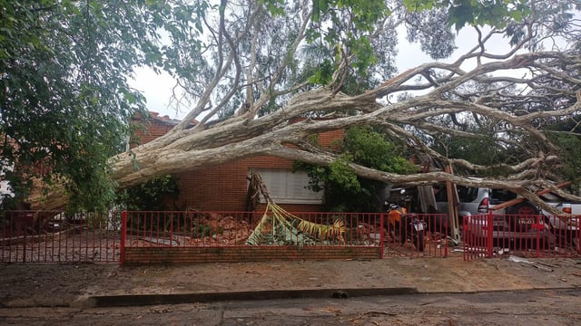
- A cold front that reached Rio de Janeiro turned skies dark and brought strong gusts, with Alerta Rio citing high severity and the Navy warning of hazardous coastal winds, as temperatures tumbled from 39°C to a forecast cap near 24°C.
- Intense heat and very low humidity persist in the interior, with Piauí setting a 42.1°C state high in Oeiras and low-humidity advisories in areas such as Sertão da Paraíba and Petrolina flagging health and wildfire risks.
- The South flipped to post-frontal cold with localized frost in Paraná (−1°C in Entre Rios) and forecasts of stable, cool mornings, while new rounds of storms today target MG, GO, MT and the DF with locally intense downpours and lightning.