
Overview
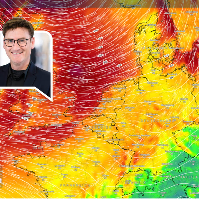
- The Deutscher Wetterdienst warns that the storm, referred to operationally as Sturmtief Detlef, will move in from Friday night with the most disruptive conditions from Saturday into Sunday, especially along the North Sea coast and in higher terrain.
- Forecast peak gusts reach about 120–130 km/h on the Brocken, around 100 km/h on the coasts, and up to roughly 65–85 km/h in some inland areas including around Hamburg and Hannover.
- DWD has issued regional warnings for sustained rain, with 30–45 liters per square meter possible in parts of the northwest and heavier orographic rainfall in the Mittelgebirge, raising a risk of localized flooding.
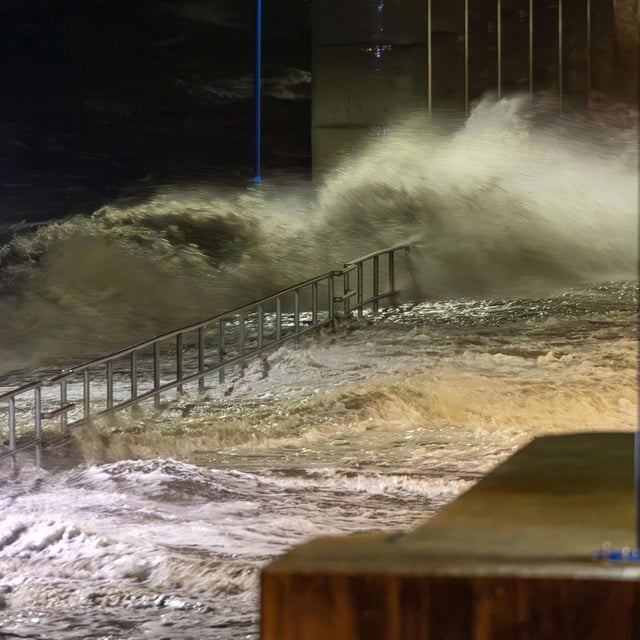
- The NLWKN expects a severe storm surge on Sunday with high tides up to about two meters above mean levels at ports including Bensersiel, Emden, Wilhelmshaven, Cuxhaven, Bremerhaven and Norderney, and operators report disruptions such as Saturday morning Emden–Borkum catamaran cancellations and possible Sunday ferry outages to Langeoog.
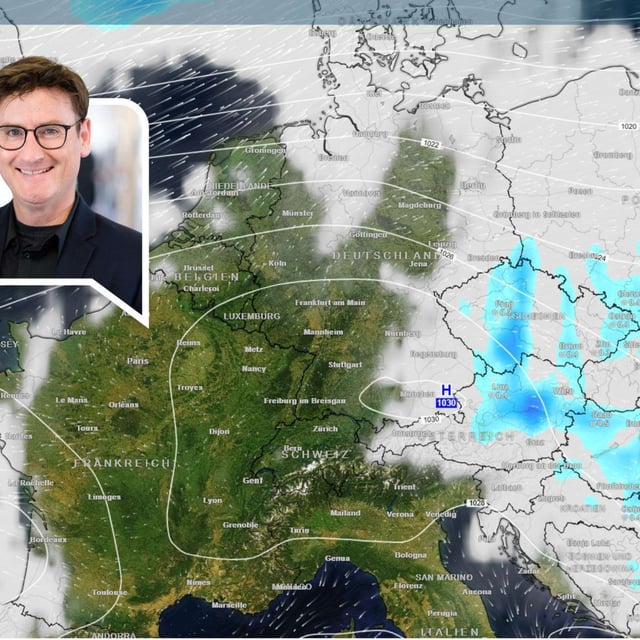
- After the storm clears, models indicate a brief warm spell early next week with temperatures likely topping 20 degrees in parts of the country.