Overview
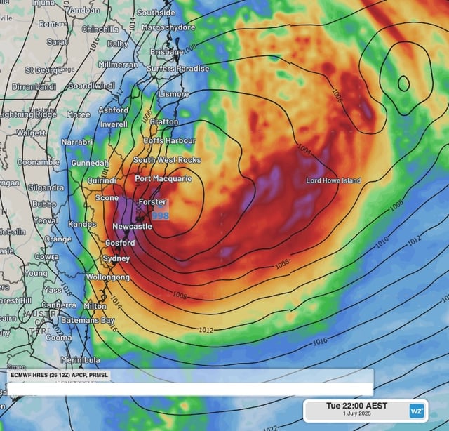
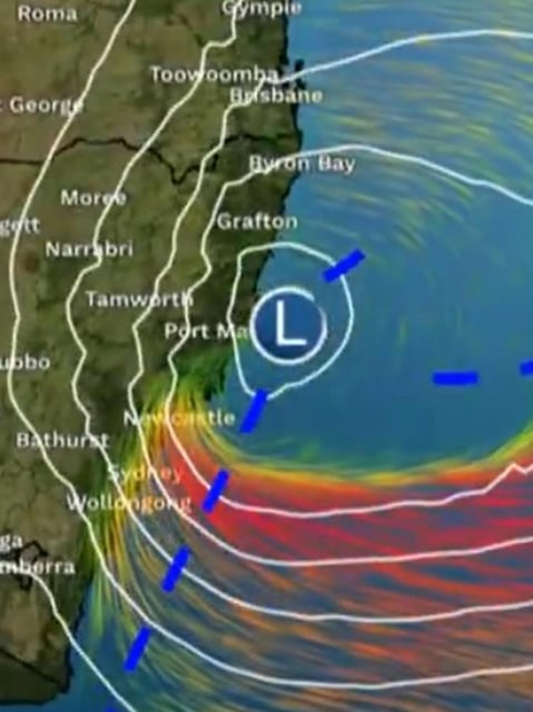
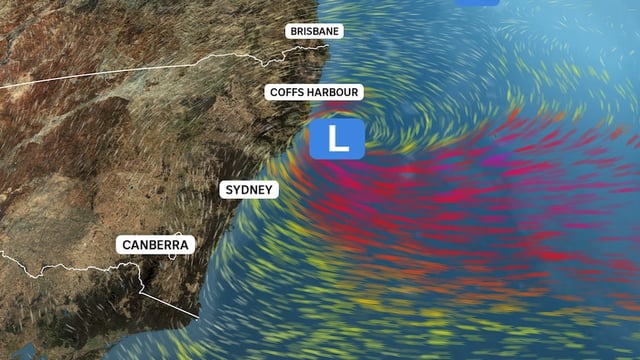
- Meteorological models forecast the low will deepen by 22–24 hPa in 24 hours, meeting bombogenesis criteria
- The system may qualify as the first East Coast Low since 2022, escalating its potential for onshore gales and coastal damage
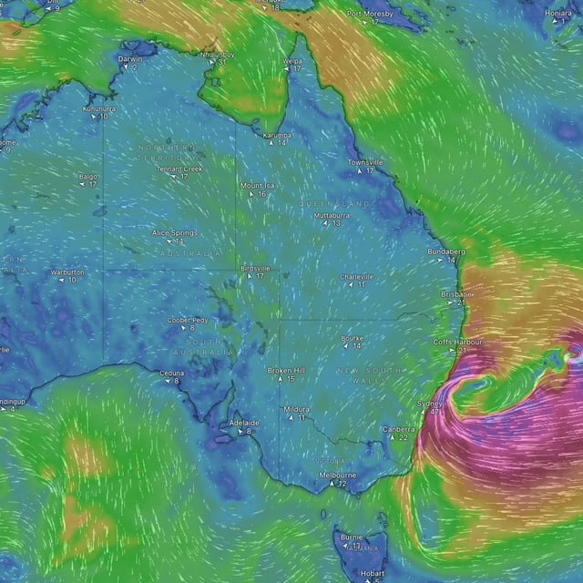
- Rainfall totals of 100–300 mm are expected across coastal catchments, heightening flash and riverine flood risks
- Wind gusts up to 100 km/h and surf heights of 5–10 metres threaten power infrastructure, trees and accelerated coastal erosion
- The Bureau of Meteorology has issued severe weather warnings and the NSW State Emergency Service has prepositioned crews along vulnerable shorelines