
Overview
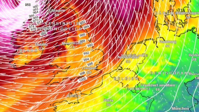
- Models track a rapidly intensifying Atlantic low toward Germany, with conditions turning wet and windy from Saturday after a mild Thursday and Friday near 17°C.
- The German Weather Service expects stürmische Böen around 70–80 km/h in inland areas such as Hannover and Hamburg, with blustery, changeable weather lasting into Sunday.
- Exposed locations are expected to see higher peaks, with coastal gusts up to about 100 km/h and up to roughly 120 km/h on the Brocken in the Harz.
- The DWD also warns of sustained rain in the low mountain ranges (Mittelgebirge), adding to the weekend’s storm hazards.
- Meteorologists use the term bomb cyclone when a low’s central pressure drops by at least 24 hPa within 24 hours, leading to rapid wind intensification.