

Overview
- IMD says the Bay of Bengal low has intensified into a well‑marked system, likely to become a depression within 24 hours and make landfall over south Odisha–north Andhra on Saturday morning.
- Odisha issued high alerts with an orange warning for extremely heavy rain in Koraput and Malkangiri, opened 20 Hirakud sluice gates and flagged rising Mahanadi flows near Mundali at about 5.6–6 lakh cusecs; Malkangiri shut schools.
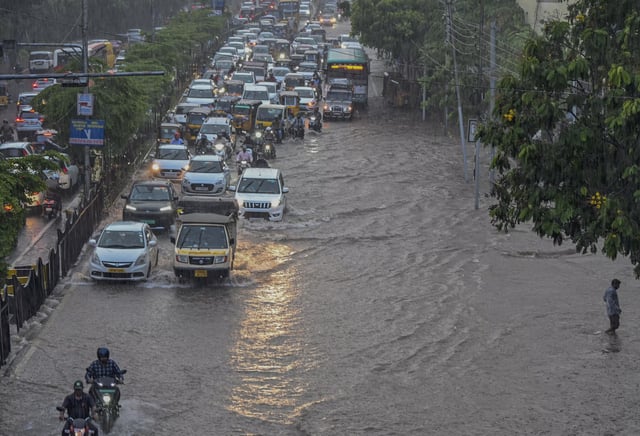
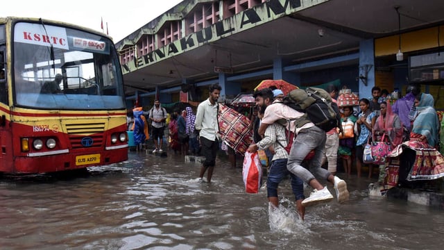
- Hyderabad saw severe waterlogging and traffic paralysis as Cyberabad police urged work from home and three IndiGo flights were diverted to Vijayawada due to poor visibility.
- Orange alerts are active across parts of Telangana, Odisha and Andhra Pradesh, while Mumbai and the Konkan have yellow warnings as scattered heavy showers continue and rough seas are flagged for fishermen.
- Maharashtra expects increased rainfall Sept 26–28 and a delayed monsoon withdrawal after Oct 5, with authorities citing 50 lakh hectares of crop damage and ₹2,215 crore already released from the disaster relief fund.