Overview
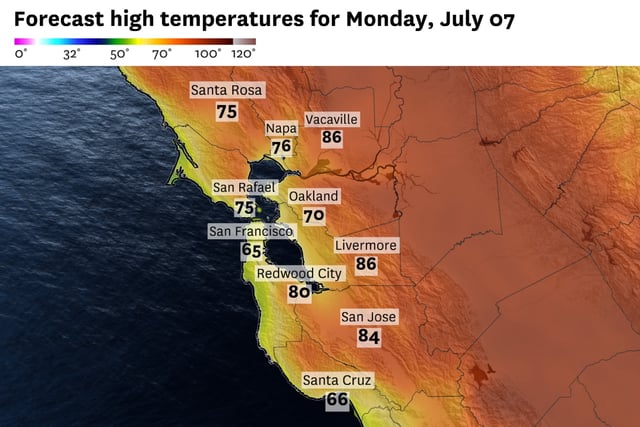
- A deep marine layer will persist through Tuesday, producing widespread overnight stratus, coastal drizzle and below-average temperatures.
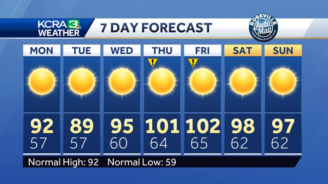
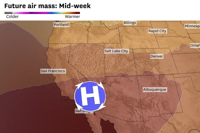
- High pressure shifting in from the Four Corners region Wednesday will spark a warming trend across interior Northern California.
- By Thursday and Friday, moderate heat risk is forecast as interior areas including the East Bay Hills and San Joaquin Valley reach upper 90s to low 100s.
- Onshore breezes will keep coastal and bay zones in the 70s and 80s, shielding them from the worst of the inland heat.
- Uncertainty in late-week temperature projections stems from split model guidance, and smoke drifting from the Madre Fire could briefly degrade air quality.