

Overview
- Much of the country started fall warm and mostly dry on Monday, with forecast models showing a Tuesday–Wednesday uptick in showers and a few thunderstorms from the Plains and Great Lakes to New England.
- New England and Maine could see roughly a quarter to one inch of rain in rounds through midweek, providing helpful but limited relief in ongoing drought conditions.
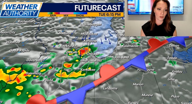
- A developing system supports a localized severe threat in parts of the Plains and Great Lakes Tuesday into Wednesday, with damaging winds and hail the main hazards and heavier totals south and toward the Lakes.
- Colorado turns sharply cooler as a cold front delivers rain to the plains and accumulating snow above about 9,000 feet in the high country, with a winter weather advisory and slick mountain passes possible into Tuesday.
- Northern California stays hot into Tuesday with some Valley cities near 100 before a cut‑off Pacific low draws in moisture and drops temperatures midweek, bringing spotty shower and thunderstorm chances; offshore, Hurricane Gabrielle remains a major storm east of Bermuda and tracks away from the U.S.