

Overview
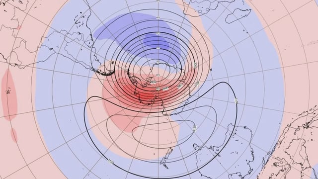
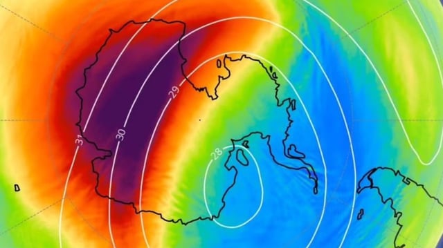
- Measurements show stratospheric temperatures over Antarctica running about 30–35C above average since early September, with polar-vortex winds roughly halved near 10 hPa.
- The Bureau of Meteorology reports a less positive Southern Annular Mode and has downgraded October from a wetter signal to no clear rainfall tilt.
- If the disturbance couples downward, stronger westerlies could boost rain over western Tasmania and parts of southern Australia while eastern and southeastern regions trend drier and warmer with more abnormally hot days.
- Key markers include 50 and 100 hPa temperatures in the upper 90th percentiles, suppressed eddy heat flux, weakened 60°S, 10 hPa winds in NASA’s MERRA-2, and a temporary ozone-hole contraction to about 15.8 million km².
- Scientists stress surface impacts remain uncertain because downward coupling is not guaranteed and other drivers, including a negative Indian Ocean Dipole and emerging Pacific signals, could alter the outcome.