Overview
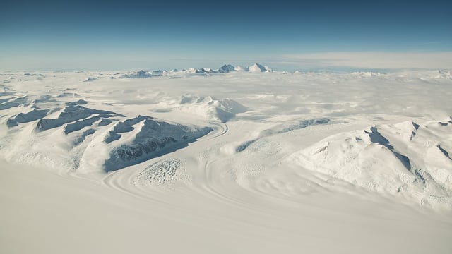
- The buried landscape lies in Wilkes Land, spanning about 12,000 square miles beneath more than a mile of ice.
- Pollen traces and radar imaging indicate the hidden world once hosted forests and possibly palm trees in a temperate environment.
- Rivers carved the terrain before it was blanketed by ice roughly 14 million years ago, preserving ridges and valleys.
- Researchers identified three massive elevated blocks up to 105 miles long and 53 miles wide, separated by valleys plunging nearly 3,900 feet deep.
- Upward shifts of as much as 1,600 feet under the ice’s weight may offer clues to how the ice sheet will behave as global temperatures rise.