Overview
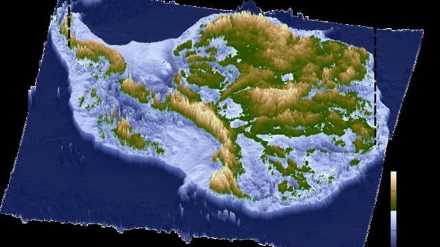
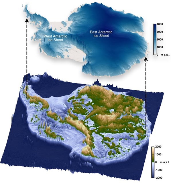
- A Nature Geoscience paper led by Durham University confirms extensive flat fluvial surfaces under 40% of East Antarctica’s 3,500 km coastline.
- These plateaus formed between 80 and 34 million years ago and have remained largely intact under ice for over 30 million years.
- Buried plateaus act as barriers that steer fast-flowing glaciers through troughs and slow current ice loss.
- Researchers will incorporate these subglacial topography features into predictive models to refine Antarctica’s future contribution to sea-level rise.
- Planned drilling campaigns aim to retrieve rock samples from the hidden landscapes to constrain their ice-free history