Overview
- The work, led by first author Nikil Krishnakumar with senior author Jiarong Hong, is published in Science of The Total Environment (2025) with DOI 10.1016/j.scitotenv.2025.179466.
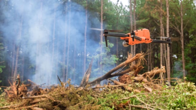
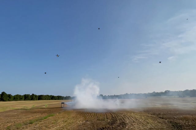
- Coordinated AI-enabled drones detect smoke, fly into plumes, sample from multiple viewpoints, and reconstruct three-dimensional structure and flow.
- The team reports that the method delivers high-resolution measurements over wide areas at lower cost than satellite tools to strengthen modeling and hazard response.
- Ongoing development targets more efficient plume tracking and particle-level measurements using Digital Inline Holography in coordinated multi-drone operations.
- Researchers are testing fixed-wing VTOL integration to extend mission range toward practical early detection, with potential use for sandstorms and volcanic ash and a need underscored by an Associated Press tally of 43 wildfires from 50,000 prescribed burns.