

Overview
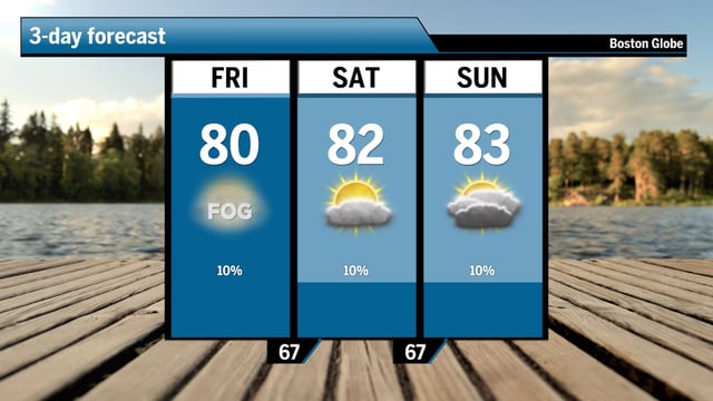
- A stalled frontal boundary shifted east on Friday, drastically reducing shower chances and allowing sunnier skies this weekend
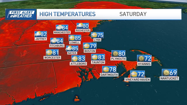
- Greater Boston is seeing highs in the upper 70s to low 80s with a mix of sun and clouds and very low chances of afternoon spot showers
- Active severe thunderstorm warnings remain in effect for parts of New Hampshire and Maine even as Southern New England enjoys calmer conditions
- Persistent coastal breezes and dew points in the mid- to upper-60s have kept daytime temperatures moderate despite elevated humidity
- Forecast models project average highs around 83°F from July 16 to 22, raising the prospect of a sustained mid-July heat wave