


Overview
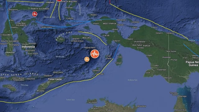
- The United States Geological Survey recorded the tremor at magnitude 6.7 with an epicenter 179 kilometers west-southwest of Tual at a 10-kilometer depth.
- Indonesia’s Meteorology, Climatology, and Geophysics Agency measured the same event at magnitude 6.9 with a deeper 108-kilometer focus, highlighting discrepancies in seismic readings.
- Both the Pacific Tsunami Warning Centre and BMKG confirmed the earthquake lacked the energy required to trigger a tsunami.
- No immediate reports of damage or casualties have emerged from the sparsely populated Tanimbar Islands region.
- Officials are monitoring for aftershocks and stressing the ongoing need for vigilant early warning systems across Indonesia’s Ring of Fire.