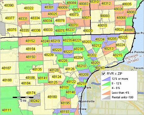
ZIP Code Tabulation Areas are statistical entities developed by the United States Census Bureau for tabulating summary statistics. These were introduced with the Census 2000 and continued with the 2010 Census and 5 year American Community Survey datasets. They were updated again for the 2020 census. This new entity was developed to overcome the difficulties in precisely defining the land area covered by each ZIP code. Defining the extent of an area is necessary in order to tabulate census data for that area. From Wikipedia