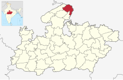
Bhind district is a district in the Chambal division of the Indian state of Madhya Pradesh. The town of Bhind is the district headquarters. Bhind District is situated in Chambal region in the northwest of the state. It is bounded by Agra, Etawah, Jalaun and Jhansi districts of Uttar Pradesh state to the north and the east, and the Madhya Pradesh districts of Datia to the south, Gwalior to the southwest, and Morena to the west. The geography of the district is characterised by uneven ravines, plain fertile fields and scanty forests. The total area of the district is 4,459 km2 (1,722 sq mi). Bhind's soil is drained by the Chambal, Kali Sind, Kunwari or Kwari, Pahuj and Baisali rivers by an extensive canal system. Formerly there were four tehsils, Bhind, Mehgaon, Gohad and Lahar, but at present there are ten tehsils: Bhind, Ater, Gormi, Mau, Mehgaon, Gohad, Lahar, Mihona, Raun and recently Amayan is the newest tehsil of Bhind. The district is part of the Chambal Division. From Wikipedia