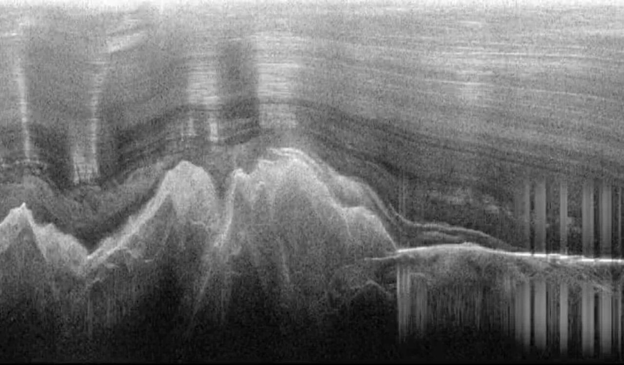
The Gamburtsev Mountain Range (also known as the Gamburtsev Subglacial Mountains) is a subglacial mountain range located in East Antarctica, just underneath the lofty Dome A, near the Southern Pole of Inaccessibility. The range was discovered by the 3rd Soviet Antarctic Expedition in 1958 and is named for Soviet geophysicist Grigoriy A. Gamburtsev. It is approximately 1,200 kilometres (750 mi) long, and the mountains are believed to be about 2,700 metres (8,900 ft) high, although they are completely covered by over 600 metres (2,000 ft) of ice and snow. The Gamburtsev Mountain Range is about the same size as the European Alps,. As of 2008, it was unknown how the mountains were formed due to the lack of data. Studies conducted during the International Polar year demonstrated that ancient plate collisions produced a core that was rejuvenated in the early to mid-Mesozoic [1]. The main features of the range formed before 34 million years ago, when the area was covered by the present ice sheet. Current models suggest that the East Antarctic ice sheet was formed from the glaciers that began sliding down the Gamburtsev range at the end of the Eocene. Vostok Subglacial Highlands form an east extension of Gamburtsev Subglacial Mountains. Gamburtsev As part of the 2007–09 International Polar Year, so called, the AGAP project was a multinational effort to gather information about the Gamburtsev mountain chain. From Wikipedia